

Real-Time
Vehicle Tracking
Smart Fleet Reporting
GPS Tracking System for Real-Time Vehicle Tracking & Fleet Visibility
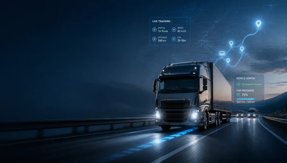
GPS Tracking System for Real-Time Vehicle Tracking & Fleet Visibility
What Is a GPS Tracking System?
Real-Time Visibility Into Your Vehicles
A GPS Tracking System combines GPS tracking hardware, satellite positioning technology, communication networks, and cloud-based software to monitor vehicle location and movement in real time.
It enables businesses to track commercial vehicles, trucks, delivery fleets, and other mobile assets while gaining greater visibility into routes, trips, vehicle activity, and fleet operations.
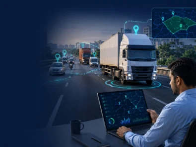
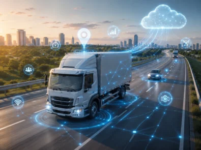
A complete GPS vehicle tracking solution typically includes:
- GPS tracking device installed in the vehicle
- Satellite-based positioning
- Cellular/GSM data communication
- Cloud-based tracking platform
- Live tracking dashboard
- Alerts and notifications
- Route and trip history
- Reports and analytics
Spectameta brings these capabilities together through a connected platform designed for modern fleet operations.
How Does a GPS Tracking System Work?
From Vehicle Location Data to Real-Time Fleet Visibility
A GPS tracking system collects location information from a tracking device installed in a vehicle and sends the data to a connected platform.
01. GPS Device Captures Location
The installed GPS tracking device receives positioning information from GPS satellites to determine the vehicle’s location.
02. Location Data Is Transmitted
The tracking device sends location and vehicle-related information through an available communication network.
03. Data Reaches the Cloud Platform
The collected information is securely transmitted to the GPS tracking platform for processing and visualization.
04. Monitor Vehicles in Real Time
Fleet managers can view vehicle locations, movement, routes, and status through the tracking dashboard.
05. Receive Alerts & Analyze Data
Configured alerts, trip history, route information, and reports help businesses monitor fleet activity and respond to important events.
GPS Tracking System for Real-Time Vehicle Tracking & Fleet Visibility
Gain complete visibility into your vehicles with Spectameta’s advanced GPS Tracking System. Monitor real-time vehicle locations, track routes, improve driver accountability, reduce unauthorized vehicle usage, and optimize fleet operations through intelligent GPS tracking technology.
Whether you manage trucks, commercial vehicles, delivery fleets, construction equipment, staff transportation, or enterprise assets, Spectameta provides reliable GPS tracking devices and cloud-based tracking software designed for Indian business operations.
Key Benefits
- Real-Time Vehicle Tracking.
- Live GPS Location Monitoring.
- Route History & Trip Playback.
- Geo-Fencing Alerts.
- Speed Monitoring & Overspeed Alerts.
- Ignition & Idle Time Tracking.
- AIS-140 Compliant GPS Devices.
- CAN Bus & Telematics Integration.
- Mobile App & Web Dashboard.
- Fleet-Wide Visibility & Control.
Track every vehicle. Monitor every trip. Improve every operation.
Key Features of Spectameta GPS Tracking System
Real-Time Vehicle Location Tracking
Track every vehicle in your fleet with live, high-accuracy positioning powered by GPS and GNSS technology. The system continuously updates vehicle location on a dynamic map, allowing fleet managers to monitor movement in real time across cities, highways, and remote areas.
This feature becomes even more powerful when combined with our Fleet Management System, where live tracking is connected with operational data like trips, driver activity, and dispatch planning.
Route History & Trip Playback
Access complete travel history for any vehicle, including route paths, stoppage points, idle time, and trip duration. This helps businesses identify inefficiencies, optimize routes, and improve delivery accuracy.
When integrated with the Telematics Solutions, route data becomes part of a larger analytics ecosystem that helps analyze driving behavior and operational performance over time.
Geo-Fencing Alerts (Smart Boundary Control)
Create virtual boundaries around warehouses, depots, customer locations, or restricted zones. The system instantly alerts you when a vehicle enters or exits a defined geo-fenced area.
This feature is widely used in logistics and transport fleets and works seamlessly with GPS Tracking System for automated monitoring without manual supervision.
Speed Monitoring & Overspeed Alerts
Monitor real-time vehicle speed and receive instant alerts when drivers exceed predefined limits. This helps reduce accidents, enforce driving discipline, and improve compliance with company policies.
For fleets using Dashcam & 360° Camera, speed data can also be correlated with driving footage for complete behavioral analysis.
Ignition, Idle & Unauthorized Movement Alerts
Stay informed about every critical vehicle event, including ignition ON/OFF, unexpected movement, and prolonged idle time. These alerts help detect unauthorized usage and reduce fuel wastage.
When paired with the Fuel Management System, businesses can directly link idle time and movement patterns with fuel consumption insights.
Multi-Device GPS Tracking Support
Spectameta supports a wide range of tracking devices depending on operational needs:
- Basic GPS tracking devices for standard vehicle monitoring
- OBD plug-and-play trackers for quick installation
- CAN bus-enabled devices for engine-level data access
- Battery-powered trackers for trailers and assets
- Wearable GPS devices for drivers and field staff
- LoRa-based trackers for low-connectivity environments
This flexibility ensures seamless integration across systems like TPMS and other IoT-based fleet sensors.
Live Data Transmission & Vehicle Intelligence
The system continuously collects and transmits critical vehicle data, including:
- Live location and movement
- Speed and route behavior
- Ignition status and trip activity
- Fuel level (CAN-enabled vehicles)
- Engine diagnostics (DTC fault codes)
- Odometer and tachometer readings
- Door status and safety alerts
This real-time data becomes significantly more powerful when connected with CAN Bus Systems, enabling deep engine-level insights for heavy vehicles and commercial fleets.
Smart Dashboard & Mobile Tracking Access
All tracking data is available through Spectameta’s cloud-based dashboard and mobile application. Fleet managers can:
- Monitor live vehicle maps
- Replay trips and analyze routes
- Set alerts and geofences
- Generate operational reports
- Manage multiple fleets from a single interface
This central control system works as the backbone of Fleet Management System, enabling businesses to scale from basic tracking to full fleet intelligence.
Commercial Fleet & Truck Tracking Optimization
For logistics and transport businesses,Spectametaprovides dedicated truck tracking features including:
- Long-haul vehicle monitoring
- Interstate route visibility
- Border and checkpoint tracking
- Night driving detection
- Delivery route optimization
These capabilities are designed to support high-volume operations where GPS tracking alone is not enough, and integration with Telematics Solutions ensures complete operational transparency.
Security, Compliance & Data Accuracy
Spectameta ensures enterprise-grade tracking security with encrypted data transmission and compliance-ready reporting. This helps businesses maintain operational transparency and regulatory standards, especially in commercial transport and logistics sectors
Technical Workflow of GPS Vehicle Tracking System
A typical GPS tracking workflow includes:
GPS Satellite Positioning → Tracking Device → Cellular/GSM Network → Cloud Platform → Tracking Dashboard → Alerts & Reports
The tracking device captures vehicle location data and transmits it to the connected platform. The platform processes this information and presents it through dashboards, maps, alerts, trip history, and reports.
This connected workflow allows businesses to move from basic vehicle location tracking to more comprehensive fleet monitoring and operational visibility.
Step 1: Vehicle Data Acquisition
The process begins with a GPS tracking device installed inside the vehicle. The device continuously gathers information from multiple sources, including GPS satellites, onboard vehicle systems, and connected sensors.
Depending on the device type and integration level, the system can collect:
- Real-time vehicle location
- Vehicle speed
- Direction of travel
- Ignition ON/OFF status
- Trip start and stop events
- Engine running hours
- Vehicle movement status
- Odometer readings
- Driver identification data
- Battery voltage information
For advanced deployments, Spectameta devices can integrate with CAN Bus Systems to retrieve vehicle diagnostics and manufacturer-specific operational data directly from the vehicle’s ECU.
Step 2: GPS & GNSS Position Calculation
The tracking device receives signals from multiple GPS and GNSS satellites to calculate the precise location of the vehicle.
The positioning engine continuously determines:
- Latitude and longitude coordinates
- Vehicle speed
- Travel direction
- Altitude information
- Movement patterns
By leveraging multiple satellite systems, the platform delivers reliable positioning accuracy even during long-distance transportation, interstate logistics operations, and remote field deployments.
Step 3: Sensor & Vehicle Parameter Monitoring
Beyond location tracking, Spectameta acts as an intelligent data gateway capable of monitoring multiple operational parameters.
The system can collect data from:
- Fuel sensors
- Temperature sensors
- Door sensors
- Driver identification systems
- RFID devices
- Panic buttons
- Trailer monitoring devices
- Engine diagnostic systems
When integrated with a Fuel Level Sensor, fleet operators gain real-time visibility into fuel levels, fuel consumption trends, and potential fuel theft incidents.
Organizations seeking deeper fuel control can further connect the system with the Fuel Management System to centralize fuel monitoring and operational reporting.
Step 4: Secure Data Transmission
Once data is collected, the GPS device securely transmits information to Spectameta servers through available communication networks.
Supported communication technologies include:
- GSM
- GPRS
- 4G LTE
- NB-IoT
- LoRa-based communication
- Hybrid connectivity options
Data transmission occurs automatically at configurable intervals or whenever predefined events occur.
Examples include:
- Vehicle starts moving
- Ignition status changes
- Speed threshold violations
- Geo-fence entry or exit
- Emergency alerts
- Sensor-triggered events
This ensures fleet managers always have access to up-to-date operational information.
Step 5: Cloud-Based Data Processing Engine
After transmission, all information is received by Spectameta’s cloud infrastructure where raw data is processed and converted into meaningful operational insights.
The cloud platform performs:
- Data validation
- Route reconstruction
- Trip calculations
- Driver activity analysis
- Event processing
- Alert generation
- Historical data storage
- Fleet performance calculations
The platform automatically organizes information into structured reports that are easy for fleet managers to understand and act upon.
Step 6: Real-Time Event Detection & Alert Generation
Spectameta continuously analyzes incoming vehicle data to identify critical operational events.
The system can automatically generate alerts for:
Vehicle Activity Alerts
- Ignition ON/OFF
- Unauthorized movement
- Excessive idling
- Route deviations
Safety Alerts
- Over-speeding
- Harsh acceleration
- Sudden braking
- Driver behavior violations
Security Alerts
- Geo-fence violations
- Tamper alerts
- Power disconnection alerts
- Asset movement alerts
Maintenance Alerts
- Service due reminders
- Fault code notifications
- Battery health warnings
When integrated with Telematics Solutions, these alerts become even more intelligent by incorporating vehicle performance and driver behavior analytics.
Step 7: Fleet Visualization & Dashboard Reporting
Processed data is displayed through the Spectameta web portal and mobile application.
Fleet managers can instantly access:
Live Tracking Dashboard
View all vehicles on a real-time GPS map with current status and movement information.
Trip & Route Analysis
Review complete trip history, route playback, stoppages, and travel patterns.
Fleet Utilization Reports
Analyze vehicle usage, operating hours, and productivity metrics.
Driver Performance Insights
Monitor driving habits and identify improvement opportunities.
Fuel & Efficiency Reports
For fleets using the Fuel Management System and Fuel Level Sensor, the dashboard provides centralized fuel analytics and consumption reports.
Step 8: Integrated Fleet Intelligence
The true power of the Spectameta GPS Tracking System lies in its ability to connect with multiple fleet technologies through a unified ecosystem.
The GPS platform serves as the foundation for:
- Fleet Management System integration
- Fuel Management System integration
- Fuel Level Sensor monitoring
- Telematics Solutions deployment
- TPMS (Tyre Pressure Monitoring System) connectivity
- Dashcam & 360° Camera integration
- CAN Bus Systems diagnostics
Instead of managing separate tools, businesses can monitor vehicle location, fuel consumption, driver behavior, tyre health, safety events, and engine performance from a single platform.
Why Spectametas Technical Workflow Matters
A GPS tracking solution is only as effective as the technology powering it. Spectameta’s architecture is designed to provide accurate location tracking, reliable data transmission, intelligent alerting, and seamless integration with advanced fleet technologies.
This end-to-end workflow helps organizations improve operational visibility, reduce unauthorized vehicle usage, optimize routes, enhance safety, and make smarter fleet management decisions based on real-time data.
Technical Architecture Overview
GPS Satellites & GNSS Networks
⬇
GPS Tracking Device Installed in Vehicle
⬇
Vehicle Sensors & CAN Bus Data Collection
⬇
GSM / GPRS / 4G Data Transmission
⬇
Spectameta Cloud Processing Engine
⬇
Real-Time Alerts & Analytics Engine
⬇
Web Dashboard & Mobile Application
⬇
Fleet Management & Business Intelligence
GPS Tracking System Use Cases Across Industries
Transportation & Logistics
Track commercial fleets, monitor routes, improve delivery visibility, and manage vehicle movement across multiple locations.
Construction
Monitor vehicles and mobile equipment operating across construction sites and project locations.
Mining
Track mining vehicles and operational assets across large or remote areas.
Manufacturing
Improve visibility into company vehicles, transportation fleets, and logistics operations.
Distribution & Delivery
Monitor delivery vehicles, track routes, and gain better visibility into vehicle movement and trip progress.
Corporate Fleets
Monitor company vehicles and improve fleet control, vehicle utilization, and operational visibility.
Logistics & Transportation Companies
Logistics businesses depend on timely deliveries and efficient route management. Spectameta GPS Tracking System provides real-time visibility into vehicle movement, helping dispatch teams monitor shipments, optimize routes, and improve customer service.
By integrating with our Fleet Management System, logistics operators can centralize vehicle tracking, trip management, and operational reporting from a single platform.
Key Benefits:
- Live truck and fleet tracking
- Route deviation alerts
- Delivery movement visibility
- Multi-city and interstate tracking
- Improved dispatch coordination
Trucking & Commercial Fleet Operations
Commercial fleet operators require complete visibility into long-haul vehicle movement, driver activity, and route compliance. Spectameta helps fleet managers monitor vehicles in real time while maintaining operational accountability.
For deeper vehicle intelligence, businesses can integrate with Telematics Solutions and CAN Bus Systems to access engine performance, diagnostics, and vehicle health data.
Key Benefits:
- Long-distance vehicle monitoring
- Route compliance tracking
- Night driving visibility
- Centralized fleet management
- Reduced unauthorized vehicle usage
Construction & Infrastructure Projects
Construction companies often manage vehicles, equipment, and machinery across multiple job sites. Spectameta GPS Tracking System enables project managers to track asset movement, improve equipment utilization, and reduce operational misuse.
When combined with a Fuel Level Sensor, businesses can also monitor fuel consumption and prevent fuel pilferage on project sites.
Key Benefits:
- Equipment and vehicle location tracking
- Job-site movement monitoring
- Improved asset utilization
- Reduced operational misuse
- Enhanced project accountability
Mining & Heavy Equipment Operations
Mining environments demand rugged and reliable tracking solutions capable of operating in remote and challenging conditions. Spectameta provides continuous visibility into heavy equipment and vehicle movement to improve operational control and safety.
Key Benefits:
- Dumper and haul truck tracking
- Remote location visibility
- Improved equipment monitoring
- Enhanced operational safety
- Long-duration tracking support
Oil, Gas & Energy Sector
Organizations operating in oil, gas, and energy industries often manage vehicles across sensitive and geographically dispersed locations. GPS tracking helps improve compliance, safety oversight, and operational transparency.
Integrating with Dashcam & 360° Camera solutions can further strengthen security and incident monitoring across critical operations.
Key Benefits:
- Vehicle monitoring in restricted zones
- Improved operational safety
- Compliance-ready movement records
- Enhanced asset security
- Centralized fleet visibility
Corporate Employee Transportation
Companies managing employee transportation services need reliable vehicle monitoring to ensure punctuality, route discipline, and passenger safety. Spectameta provides real-time tracking and automated alerts for transport operations.
Key Benefits:
- Live vehicle visibility
- Route and stop monitoring
- Reduced delays
- Improved transport planning
- Enhanced employee safety
School & Educational Institution Transport
Student safety is a top priority for educational institutions. Spectameta GPS Tracking System enables schools to monitor buses in real time and maintain transparency with parents and administrators.
For enhanced safety monitoring, schools can integrate tracking systems with Dashcam & 360° Camera solutions.
Key Benefits:
- Real-time school bus tracking
- Route adherence monitoring
- Improved student safety
- Faster emergency response
- Better transport management
Rental, Leasing & Asset-Based Fleets
Vehicle rental and leasing companies require complete visibility into vehicle usage and movement. GPS tracking helps prevent unauthorized use while protecting valuable assets.
Key Benefits:
- Usage-based vehicle monitoring
- Theft prevention support
- Asset visibility and tracking
- Short-term and long-term deployment options
- Improved operational control
Government & Public Sector Fleets
Government departments and public sector organizations use GPS tracking to improve transparency, monitor official vehicle utilization, and support compliance requirements.
By integrating with the Fleet Management System, organizations can streamline reporting and maintain accurate operational records.
Key Benefits:
- Centralized vehicle tracking
- Audit-ready reporting
- Improved fleet accountability
- Better resource utilization
- Enhanced operational oversight
E-Commerce & Last-Mile Delivery Operations
Last-mile delivery businesses require real-time visibility and route optimization to meet customer expectations and delivery timelines. Spectameta helps delivery operators track vehicles, improve dispatch efficiency, and monitor delivery performance.
Combining GPS tracking with a Fuel Management System can further reduce operating costs and improve delivery profitability.
Key Benefits:
- Live delivery vehicle tracking
- Route optimization support
- Faster dispatch decisions
- Improved delivery reliability
- Enhanced customer service
A GPS Tracking Solution Built for Every Industry
No two industries operate the same way, which is why DieselMap GPS Tracking System is designed to be flexible, scalable, and integration-ready. From logistics fleets and construction projects to school transportation and government operations, businesses can leverage real-time tracking data to improve efficiency, increase security, and make better operational decisions.
As your requirements grow, the system can seamlessly integrate with Fleet Management System, Fuel Management System, Fuel Level Sensor, Telematics Solutions, TPMS, Dashcam & 360° Camera, and CAN Bus Systems to create a complete connected fleet ecosystem.
Why Choose Spectameta GPS Tracking System?
Real-Time GPS Tracking for Smarter Fleet Operations
Spectameta combines GPS tracking, connected vehicle data, alerts, dashboards, and analytics to help businesses gain greater control over their fleets.
With Spectameta, businesses can:
- Track vehicles in real time
- Monitor vehicle routes and trips
- Improve fleet visibility
- Monitor speed and vehicle activity
- Set geofencing alerts
- Review historical routes
- Improve vehicle security
- Monitor commercial fleets
- Analyze fleet activity
- Make data-driven operational decisions
Our GPS tracking solutions are designed to provide practical visibility that helps businesses manage vehicles more efficiently.
Accurate Real-Time Vehicle Tracking
Spectameta delivers precise location updates using advanced GPS and GNSS positioning technology. Fleet operators can monitor vehicle movement in real time, track route progress, and quickly respond to operational changes without relying on manual driver updates.
With continuous location monitoring, businesses gain better visibility into vehicle activities across cities, highways, and remote operating environments.
Comprehensive Route History & Trip Visibility
Every trip is automatically recorded, allowing businesses to review complete travel history, route paths, stoppages, and journey durations.
This visibility helps improve route planning, verify completed trips, and maintain greater accountability across transportation operations.
Instant Alerts for Better Operational Control
Spectameta provides automated alerts that keep fleet managers informed about critical vehicle activities.
Receive notifications for:
- Over-speeding events
- Geo-fence entry and exit
- Ignition ON/OFF status
- Unauthorized movement
- Extended idle time
- Route deviations
Real-time alerts enable faster decision-making and proactive fleet supervision.
Access Your Fleet Anytime, Anywhere
Monitor vehicles through a user-friendly web dashboard and mobile application designed for operational convenience.
Fleet managers can:
- View live vehicle locations
- Track ongoing trips
- Replay historical routes
- Monitor vehicle status
- Receive instant notifications
This ensures complete visibility regardless of location.
Suitable for All Vehicle Types
Spectameta GPS Tracking System supports a wide range of vehicle categories, including:
- Commercial trucks
- Logistics vehicles
- Delivery fleets
- School buses
- Employee transport vehicles
- Construction vehicles
- Rental fleets
- Government vehicles
The platform can easily adapt to different industries and operational requirements.
Reliable Tracking Hardware & Connectivity
Our GPS tracking devices are engineered for dependable performance and stable communication.
The system supports:
- GPS/GNSS positioning
- GSM/GPRS communication
- 4G network connectivity
- Real-time data transmission
- Cloud-based tracking infrastructure
This ensures accurate and uninterrupted vehicle tracking throughout daily operations.
Secure Cloud-Based Tracking Platform
All vehicle data is securely processed and stored on the Spectameta cloud platform.
Users can access:
- Live tracking information
- Trip history
- Route reports
- Vehicle activity logs
- Alert records
from a centralized and secure environment designed for business use.
Scalable for Growing Operations
Whether you’re tracking a single vehicle or managing hundreds of assets, Spectameta grows alongside your business.
The platform is designed to support:
- Small business fleets
- Regional transport operators
- Nationwide logistics companies
- Enterprise-scale vehicle networks
without compromising performance or reliability.
Expert Support & Hassle-Free Deployment
Our team assists with device installation, platform setup, onboarding, and ongoing support to ensure a smooth implementation process.
From initial deployment to long-term usage, Spectameta helps businesses maximize the value of their GPS tracking investment.
Trusted GPS Tracking Solution for Modern Businesses
Spectameta combines reliable GPS tracking hardware, real-time monitoring capabilities, and an intuitive cloud platform to help businesses improve visibility, strengthen operational control, and make informed decisions based on accurate vehicle data.
With powerful tracking features, flexible deployment options, and dedicated support, Spectameta is a trusted choice for organizations seeking a dependable GPS Tracking System for commercial and business applications.
Real-Time GPS Tracking for Smarter Fleet Visibility
Track vehicles live, optimize routes, and improve fleet efficiency with Spectameta GPS Tracking.
Frequently Asked Questions
What is a GPS Tracking System?
A GPS Tracking System is a technology solution that uses GPS satellites, tracking devices, and cloud-based software to monitor the real-time location and movement of vehicles. Businesses use GPS tracking to improve visibility, monitor routes, track vehicle activity, and maintain better operational control across their transportation network.
How does a GPS Tracking System work?
A GPS tracking device installed in the vehicle receives location data from GPS satellites and transmits it through a mobile network to a secure cloud platform. Fleet operators can then view live vehicle locations, route history, trip information, and alerts through a web dashboard or mobile application.
What types of vehicles can be tracked using a GPS Tracking System?
GPS tracking can be used on a wide range of vehicles, including:
- Commercial trucks
- Delivery vehicles
- Logistics fleets
- School buses
- Employee transportation vehicles
- Construction vehicles
- Rental vehicles
- Government fleet vehicles
The system can be customized to suit different vehicle categories and operational requirements.
How accurate is GPS vehicle tracking?
Modern GPS tracking systems provide highly accurate location data, typically within a few meters under normal operating conditions. Accuracy may vary slightly depending on satellite visibility, environmental conditions, and network coverage, but real-time tracking remains highly reliable for commercial fleet operations.
Can I monitor vehicles in real time?
Yes. Spectameta GPS Tracking System provides real-time vehicle visibility through a live tracking dashboard. Users can instantly view vehicle locations, movement status, travel routes, and operational activity from any internet-connected device.
What information can a GPS Tracking System provide?
In addition to vehicle location, the system can provide:
- Speed information
- Route history
- Trip details
- Idle time records
- Ignition status
- Stop duration reports
- Geo-fence alerts
- Vehicle activity logs
The available information depends on the type of GPS tracking device installed.
What is route playback in GPS tracking?
Route playback allows users to review historical trips and visualize the exact path traveled by a vehicle. This feature helps businesses verify routes, analyze travel patterns, investigate incidents, and improve operational planning.
What are geo-fence alerts?
Geo-fencing allows businesses to create virtual boundaries around locations such as warehouses, depots, customer sites, or restricted areas. The system automatically sends alerts whenever a vehicle enters or exits a predefined zone, helping improve monitoring and operational control.
Does GPS tracking work across different cities and states?
Yes. GPS tracking systems are designed to monitor vehicles across local, regional, and interstate routes. As long as the tracking device has access to satellite signals and network connectivity, vehicle movement can be monitored from virtually anywhere.
Can GPS tracking help improve vehicle security?
GPS tracking improves vehicle security by providing continuous visibility into vehicle movement. Features such as real-time location monitoring, unauthorized movement alerts, and route tracking help businesses respond quickly to suspicious activity and improve asset protection.
Can I access GPS tracking data on my mobile phone?
Yes. Spectameta GPS Tracking System offers mobile access, allowing users to monitor vehicles, receive alerts, view trip history, and track fleet activity directly from their smartphones or tablets.
What industries commonly use GPS Tracking Systems?
GPS tracking is widely used across industries that rely on vehicle movement and asset visibility, including:
- Logistics and transportation
- Trucking and commercial fleets
- Construction and infrastructure
- Mining operations
- School transportation
- Corporate transport services
- Vehicle rental companies
- Government fleet operations
- Last-mile delivery businesses
Trip history
Alert records
Live tracking
Ready to Track Your Fleet in Real Time?
Get real-time vehicle locations, route visibility, geofencing alerts, trip history, and fleet insights from one connected GPS tracking platform.