


GPS Tracking for Commercial Vehicles: How It Works & What Fleet Managers Can Monitor
Commercial vehicles rarely operate from one fixed location. Trucks travel between cities, delivery vehicles move through multiple stops, service fleets visit customer sites, and construction vehicles may operate across several projects.
For fleet managers, simply knowing that a vehicle has left the depot is not enough. They often need to understand where the vehicle is, whether it is moving, how a trip is progressing, where it stopped and whether an exception needs attention.
GPS-based vehicle monitoring provides this visibility.
When GPS data is connected with fleet software, telematics and other vehicle technologies, businesses can move beyond manual driver calls and gain a clearer view of day-to-day fleet activity.
This guide explains how commercial vehicle tracking works, what information fleet managers can monitor, where it is useful, and what businesses should consider before choosing a solution.
What Does GPS Tracking Mean for a Commercial Fleet?
GPS uses satellite signals to provide positioning, navigation and timing information. A receiver installed in or connected to a vehicle uses those signals to determine its location. GPS itself provides positioning information; a connected tracking system then communicates that information to fleet software where managers can view it.
For fleet operations, the process generally involves:
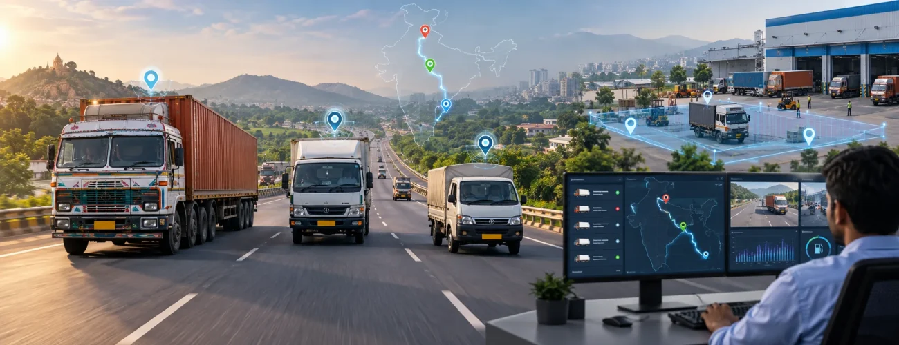
Vehicle → GPS device → communication network → cloud platform → fleet dashboard
This allows vehicle location and movement information to be reviewed remotely.
A commercial fleet may use this information to monitor:
- Current vehicle position
- Vehicle movement
- Trip progress
- Historical routes
- Stops
- Arrival and departure activity
- Geofence activity
- Speed information
- Vehicle availability
- Operational exceptions
GPS is therefore more useful for fleet operations when it becomes part of a broader connected vehicle monitoring workflow.
How Vehicle Tracking Works
Although implementations differ between providers, most systems follow four basic stages.
The Device Determines Vehicle Position
A compatible GPS receiver uses satellite signals to calculate the vehicle’s position.
The tracking device may be permanently installed in the vehicle or integrated with another telematics unit.
Information Is Sent to a Platform
Location data is transmitted through a supported mobile or communication network.
Additional information may also be transmitted depending on the installed equipment.
The Software Organizes Vehicle Activity
The platform converts incoming information into useful views such as:
- Maps
- Vehicle lists
- Trip histories
- Route records
- Alerts
- Geofence events
- Reports
This makes fleet data easier for an operations team to understand.
Fleet Teams Review Exceptions
The most important stage is not displaying dots on a map.
It is using the information to answer operational questions.
For example:
A delivery vehicle has not reached its destination at the expected time.
The manager can review:
- Current location
- Route history
- Recent stoppages
- Trip progress
- Any route deviation
- Whether the vehicle has started moving again
This provides more context before the team contacts the driver or customer.
What Can Fleet Managers Monitor?
Commercial vehicle tracking can provide several types of operational information.
Live Vehicle Location
A live map helps managers understand where fleet vehicles are operating.
This can be useful when:
- Coordinating multiple vehicles
- Checking trip progress
- Responding to customer enquiries
- Dispatching a nearby vehicle
- Monitoring remote operations
The purpose is not simply constant observation. It is providing vehicle information when an operational decision needs to be made.
Vehicle Movement and Status
Location data can also help distinguish between vehicles that are:
- Moving
- Stopped
- Parked
- At a depot
- At a customer location
- At a project site
This gives fleet teams a quicker view of active and inactive vehicles.
Trip History
Historical trip information can help answer questions that a live map cannot.
Managers may review:
- Where a trip started
- Where it ended
- Distance travelled
- Travel duration
- Routes used
- Stops made
- Time spent at locations
This creates a record of actual fleet activity.
Route Deviations
A vehicle may sometimes leave its expected route because of traffic, road restrictions, customer requests or operational decisions.
Route history allows fleet managers to investigate rather than assume why a deviation occurred.
Repeated deviations can also indicate that route planning deserves review.
Stoppages
Not every stop is a problem.
A commercial vehicle may stop because of:
- Loading
- Unloading
- Traffic
- Driver breaks
- Customer delays
- Refuelling
- Vehicle problems
However, unexpectedly long or repeated stoppages may require investigation.
Vehicle Speed
Supported tracking systems may provide speed information associated with vehicle movement.
Fleet teams can use this information as one part of a broader driver monitoring process.
Individual speed events should be reviewed in operational context rather than treated as complete evidence of driver performance.
Using Geofences to Monitor Important Locations
A geofence is a virtual boundary created around a physical location.
Businesses commonly create geofences around:
- Fleet depots
- Warehouses
- Customer sites
- Construction projects
- Mines
- Distribution centres
- Fuel stations
- Industrial plants
- Restricted areas
When a vehicle enters or exits the defined area, the system can record the event.
Depot Monitoring
Fleet operators can review when vehicles leave and return to their operating base.
Customer-Site Visibility
Arrival and departure activity can help businesses confirm when commercial vehicles reached a customer location.
Project-Site Monitoring
Construction or infrastructure companies may use geofences around projects to understand which vehicles are operating at each site.
Restricted-Zone Alerts
Businesses can also define locations that vehicles should not normally enter and investigate exceptions when they occur.
Geofencing becomes most useful when boundaries are connected with a clear operational purpose rather than creating dozens of unnecessary alerts.
Live Tracking vs Trip History
These two capabilities answer different questions.
| Fleet Question | Live Monitoring | Historical Trip Data |
|---|---|---|
| Where is the vehicle now? | Yes | No |
| Is it moving? | Yes | Limited |
| Which route did it use yesterday? | No | Yes |
| Where did it stop? | Limited | Yes |
| Is a current trip delayed? | Yes | Supporting context |
| Did the same issue happen previously? | No | Yes |
A strong fleet workflow uses both.
Live monitoring supports immediate decisions. Historical data supports investigation and analysis.
How Vehicle Location Data Supports Fleet Operations
Location information becomes more valuable when businesses connect it to actual operational problems.
Faster Dispatch Decisions
If several vehicles are available, the operations team can identify which vehicle is positioned appropriately for the next assignment.
This may be useful for:
- Service fleets
- Delivery operations
- Recovery vehicles
- Field teams
- Logistics fleets
Better Trip Coordination
Dispatch teams can follow active trips without continuously contacting drivers for location updates.
Improved Customer Communication
When a customer requests a vehicle-status update, operations teams can review available trip information before responding.
This can reduce reliance on estimated updates based only on phone calls.
Easier Exception Investigation
When a delivery is late, a manager can examine route and stop history before deciding what happened.
The system does not automatically explain the cause, but it provides evidence that can support investigation.
GPS Tracking vs Fleet Telematics
These terms are related but should not be treated as identical.
GPS tracking primarily provides vehicle position and movement information.
Telematics can combine that location information with additional vehicle or operating data.
| Information | GPS Tracking | Broader Telematics |
|---|---|---|
| Location | Yes | Yes |
| Route history | Yes | Yes |
| Trips | Yes | Yes |
| Geofencing | Often | Yes |
| Speed | Often | Yes |
| Fuel information | Usually limited | Possible |
| Engine hours | Limited | Possible |
| Driver events | Limited | Possible |
| CAN Bus data | No/basic | Possible |
| Vehicle diagnostics | Limited | Possible |
The exact information available depends on the vehicle, hardware and integration.
This distinction is important because businesses sometimes purchase a basic tracker while expecting data that requires a more advanced telematics platform.
How Location Data Works with Fuel Monitoring
GPS information alone does not directly explain why a vehicle consumed more fuel.
However, location and trip data can provide valuable context when combined with fuel monitoring.
Suppose one truck shows unusually high fuel consumption.
The fleet manager can examine:
- Distance travelled
- Route used
- Number of trips
- Stoppages
- Idling activity where available
- Refuelling events
- Fuel-level changes
- Vehicle operating conditions
Instead of looking at the fuel number in isolation, the manager gains a broader picture of the trip.
This is why connected fleet data is generally more useful than separate systems that cannot be compared.
Supporting Driver Safety with Vehicle Data
Vehicle tracking can contribute to driver-safety programs when used appropriately.
Depending on the system, fleet managers may review:
- Speed events
- Route behaviour
- Long driving periods
- Unexpected movement
- Stops
- Harsh-driving events when telematics is available
The purpose should be to identify patterns that may require investigation or coaching.
For fleets requiring additional context, dashcams and driver-monitoring technology can complement location data with visual or behavioural information.
Tracking Different Types of Commercial Vehicles
Not every commercial fleet should be monitored in exactly the same way.
Trucks and Long-Haul Vehicles
Useful information may include:
- Long-distance trip progress
- Route activity
- Stops
- Depot arrivals
- Customer-site arrivals
- Driver events
Delivery Vehicles
Distribution fleets may focus on:
- Multiple stops
- Delivery sequences
- Route progress
- Vehicle availability
- Warehouse activity
Construction Vehicles
Construction businesses may monitor:
- Tippers
- Dump trucks
- Transit mixers
- Excavators
- Loaders
- Cranes
- Road rollers
For equipment that spends most of its time within one project area, engine hours, utilization and geofencing may be more useful than road distance alone.
Oil and Gas Fleets
Tanker and service-vehicle operations may use location data for:
- Highway movement
- Terminal activity
- Route monitoring
- Site entry and exit
- Remote fleet visibility
Rental and Leasing Vehicles
Rental businesses can use location and usage information to maintain better visibility across vehicles assigned to different customers.
Measuring Vehicle Utilization
Tracking information can also help businesses understand how often assets are actually being used.
A simple utilization formula can be:
Vehicle Utilization (%) = Active Operating Time ÷ Available Time × 100
However, the definition of active time should reflect the fleet.
For a road vehicle, distance or trip time may be useful.
For an excavator or loader, engine operating hours may be more meaningful.
Avoid applying one utilization benchmark to every vehicle in the business.
Compare:
- Similar vehicle types
- Similar operating roles
- Similar routes
- Similar work conditions
This produces more meaningful fleet analysis.
Common Problems Basic Tracking Can Help Investigate
Tracking software does not automatically solve fleet problems, but it can provide information needed for investigation.
Unplanned Route Changes
Review route history and determine whether the deviation was operationally justified.
Repeated Long Stops
Compare the duration and locations of stops across similar trips.
Delayed Customer Arrivals
Review the trip sequence to understand where the delay developed.
Underused Vehicles
Compare activity among vehicles performing similar work.
Unauthorized Movement
Investigate vehicle activity outside expected operating times or areas according to appropriate company policies.
Dispatch Uncertainty
Use available location information to determine which vehicles are active or available.
What GPS Data Cannot Tell You by Itself
One of the biggest implementation mistakes is expecting location tracking to explain every fleet problem.
Location data can tell you where and when something happened.
It may not tell you why.
For example:
A truck stopped for 45 minutes.
GPS data can show the stop.
It cannot necessarily determine whether the cause was:
- Traffic congestion
- Loading delays
- Driver rest
- Vehicle breakdown
- Customer waiting time
- Road closure
Additional operating data or human investigation may still be required.
Similarly, basic location data usually cannot provide detailed information about:
- Fuel level
- Engine health
- Diagnostic trouble codes
- Tyre pressure
- Camera footage
- Detailed driver behaviour
Those areas may require additional technologies.
When Does a Fleet Need More Than GPS?
Businesses may need a broader connected platform when the questions become more detailed.
If the main requirement is:
Where are my vehicles?
Location tracking may be sufficient.
But if the questions include:
Why is this vehicle using more fuel?
Is the engine approaching a maintenance threshold?
Which drivers repeatedly generate harsh events?
What happened during an incident?
What vehicle fault information is available?
Then additional technologies may be needed.
These can include:
- Fleet management software
- Telematics
- Fuel level sensors
- CAN Bus integration
- Driver monitoring
- Dashcams
- TPMS
- Maintenance systems
The right solution should match the operational questions the business needs to answer.
What to Look for Before Choosing a Vehicle Tracking Solution
Businesses should evaluate more than just the tracking device.
Reliable Vehicle Visibility
The system should provide the level of location and trip information required for your operations.
Historical Reporting
Check how easily managers can review previous trips, stops and routes.
Useful Geofencing
Businesses should be able to define operationally important locations and review related events.
Alert Configuration
Alerts should be configurable around meaningful fleet events.
Suitable Hardware
The selected device needs to match the vehicle type and operating environment.
Platform Usability
Dispatchers and managers should be able to find important information without navigating overly complicated dashboards.
Integration Capability
Consider whether the business may later need to connect:
- Fuel sensors
- CAN Bus
- Cameras
- Driver monitoring
- Maintenance information
Implementation Support
Hardware installation, configuration and training can affect how successfully the system is adopted.
Basic Tracker or Connected Fleet Platform?
The correct choice depends on business requirements.
A basic tracker may be suitable when the company mainly wants:
- Vehicle location
- Trip history
- Basic routes
- Simple geofences
A broader platform may make more sense when the operation also requires:
- Fuel insights
- Driver monitoring
- Maintenance data
- Fleet analytics
- Camera integration
- Vehicle data
- Multiple types of alerts
Do not choose the most complicated system simply because more features are available.
Choose the system that helps the operations team solve real fleet problems.
A Practical Monitoring Workflow
Technology works best when teams know what should happen after an alert or exception appears.
A simple workflow is:
Detect → Review → Investigate → Act → Measure
Detect
An exception appears.
Example: a vehicle remains stopped longer than expected.
Review
Check:
- Vehicle location
- Stop duration
- Route
- Trip stage
- Nearby geofence activity
Investigate
Determine whether the stop was expected or whether additional information is required.
Act
Depending on the situation, the operations team may contact the driver, update a customer or adjust the trip plan.
Measure
If the issue occurs repeatedly, review historical information and look for a recurring pattern.
This turns location data into an operational process rather than simply a map display.
How Spectameta Supports Connected Vehicle Operations
Spectameta helps businesses connect commercial vehicles with the information needed for better fleet visibility and operational control.
Depending on fleet requirements, connected solutions can include:
- GPS vehicle tracking
- Fleet management
- Telematics
- Fuel monitoring
- Driver monitoring
- CAN Bus integration
- Dashcams and vehicle cameras
- Fleet analytics
Businesses can start with location monitoring and extend the system when additional vehicle information becomes necessary.
The objective is to build a connected fleet environment where managers can monitor relevant events, investigate exceptions and make informed operational decisions.
Frequently Asked Questions
Conclusion
Commercial vehicle tracking provides fleet managers with more than a current vehicle location.
When used properly, location and trip information can help teams understand vehicle movement, routes, stoppages, geofence activity, trip progress and asset utilization.
The strongest approach is not to monitor every possible data point.
It is to identify the fleet questions that matter, collect the right information and create a clear process for responding to exceptions.
For businesses that later need deeper insight into fuel, drivers, maintenance or vehicle health, GPS data can become the foundation for a broader connected fleet environment.
Improve Commercial Vehicle Visibility with Spectameta
Connect your vehicles with GPS tracking, telematics and fleet-management technology designed for modern commercial operations.
